ADVANTAGES

About the program

CADdrawing.agent is a program solution for automatized and standardized drawing within AutoCAD graphic environment

It is intended for all those who want to establish a system of accurate, simple and intuitive drawing, as well as make visually and technically balanced designs/spatial plans.

Program has been completely developed as a modularly adjustable system to use in all thematic areas and it is possible to order an customized version in accordance with the standard of your company or project.

Currently available modules are those for automated drawing of spatial plans, as well as communal infrastructure (water supply, sewer system and electric supply) and environmental protection.

CADdrawing.agent is started from the cloud and is accessible at any time and any location, whereas new program versions are available immediately. Program is on offer as a service on the monthly subscription basis.

Advantages

CADdrawing.agent directs the user towards corporate standardized drawing or drawing adapted to a certain project

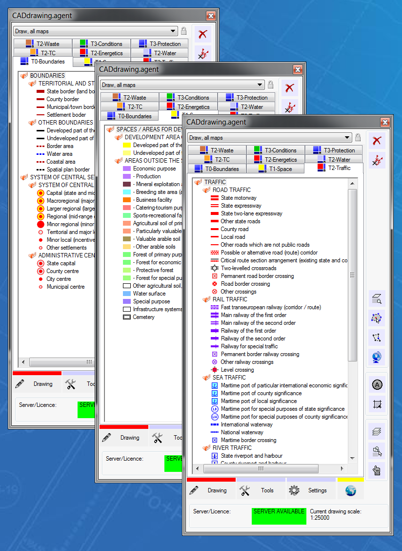
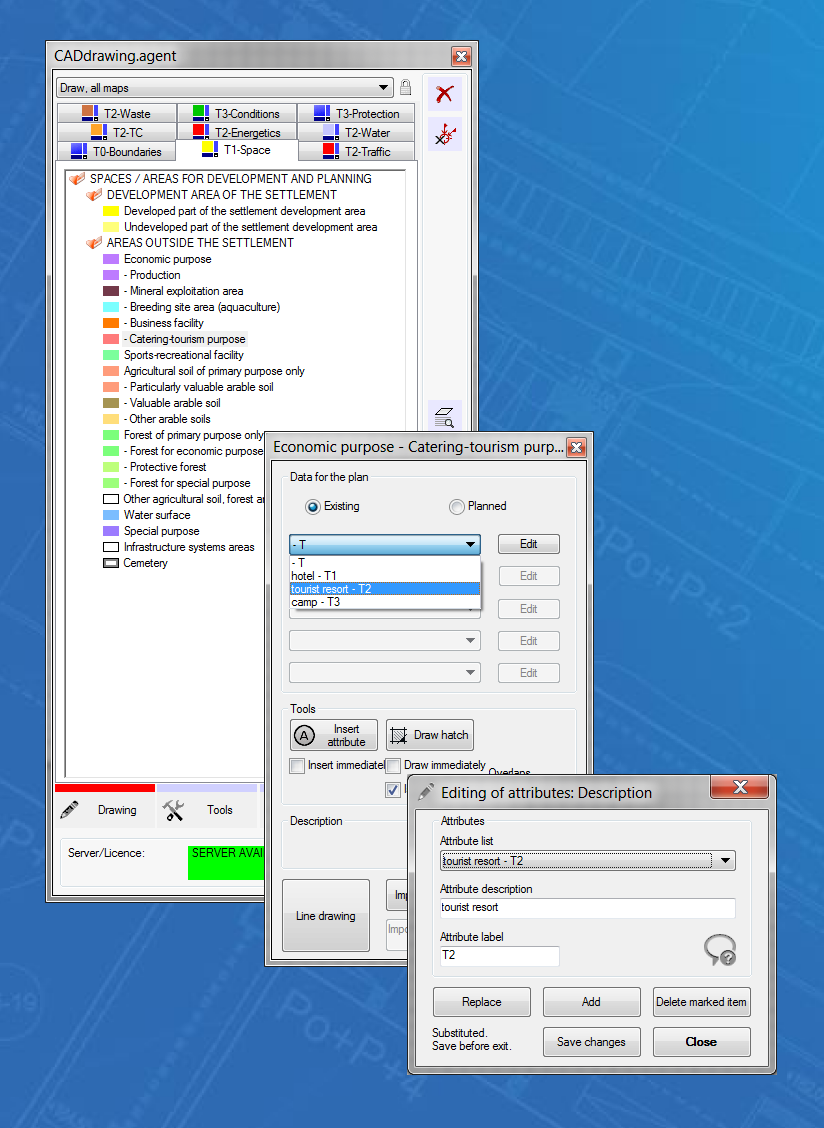
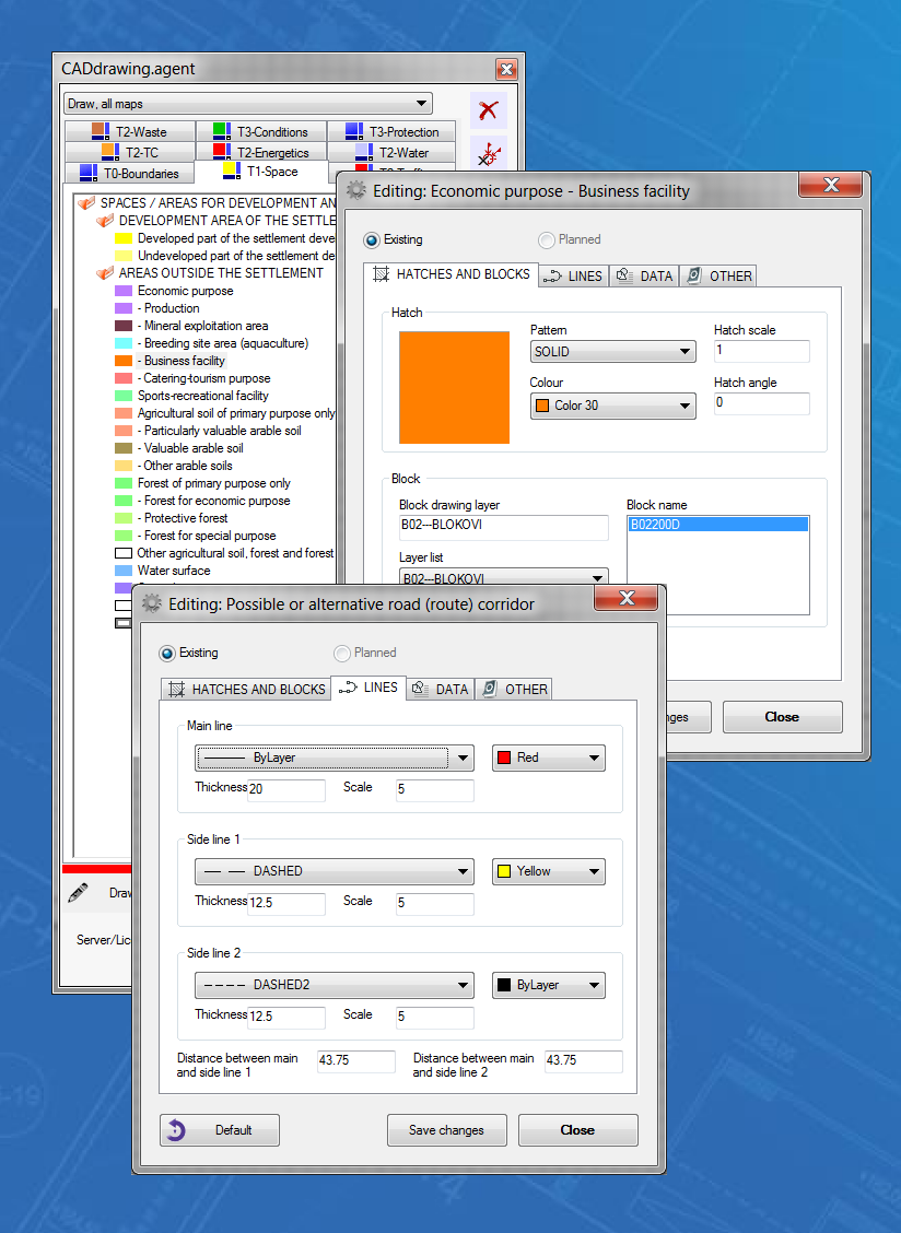
Use of CADdrawing.agent largely cuts down the number of errors found during usual drawing in CAD programs.

DIRECTED
DRAWING

Graphic menu offers all themes
and objects necessary for work,
and helps the user focus on the creation of design

SIMPLE
UPGRADE

Existing project/plan base can be used with simple and automatized customization

SAAS
SERVICE IN CLOUD

CADdrawing.agent is started
from the central server [cloud],
and upgrades to new versions
are available immediately

EFFICIENCY
INCREASE

Automatic drawing
of multiple lines and hatches,
sorting according to layers,
colours and linetypes

ASSOCIATING
OF INFORMATION

Attribute data are automatically associated with drawn elements
and prepared for GIS

PROGRAM
ACCESSIBILITY

Due to the fact that it is
started from the cloud
the program is accessible always and from any location

DRAWING
ACCURACY

Predefined themes, as well as automatic sorting by layers,
colours and linetypes decreases the number of user errors

TRANSFER OF
DATA TO GIS

Supported GML format
for graphic exchange between
CAD and GIS programs

STANDARDIZED
PROJECTS

Predefined themes and
modes of drawing give
uniformity to projects
being created

PROGRAM
CUSTOMIZATION

Possibility to order your own module customized to company or project standard

CONTACT